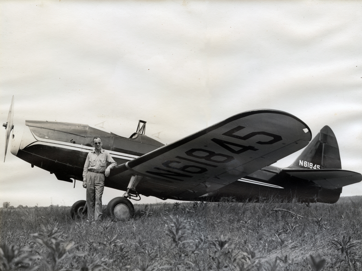
Wheeler Searles with his Fairchild PT-19 at Brodhead Airport. 1946-47. Searles flew P-38 fighter/bombers in WWII.
Brodhead Airport has existed at its current location since January, 1946, when B-24 bomber pilot Maj. Bill Earleywine returned home from World War II and rented a field south of town in order to establish a flight instruction and sightseeing operation. Taylorcraft and Ercoupe dealerships were added soon after and Bill kept busy giving instruction and charter flights to Brodhead locals at “Bill’s Airpark”. The field belonged to the family of Wheeler Searles, also a local WWII pilot who flew fighter/bomber missions in P-47s in Europe. Wheeler owned a Fairchild PT-19 that he kept at the “airpark”.
In July, 1947, tragedy struck when Bill and his brother Derald were killed when their plane crashed in a pasture just south of the Brodhead Airport as they were returning from Wisconsin State Air Fair and Circus at nearby Rock County Airport. Operations slowed with the abrupt end of Earleywine Flying Service but a handful of pilots continued to keep the airport open.

Bob Green, a local farmer who flew B-24 bombers in WWII, with his Waco UPF-7 at Brodhead Airport. Early 1960s.

Jerry Edgar’s Taylorcraft at Brodhead Airport, 1967
In the 1950s through the early 70s, these local pilots kept the field mowed and pitched in to pay the rent while flying a few small airplanes from Brodhead Airport. Robert Green, another local WWII B-24 pilot, owned a Taylorcraft and later, a Waco UPF-7. Jerry Edgar kept a Taylorcraft and later, a Piper Cherokee. Don Mason had a Luscombe and Darrell Nelson owned a Cessna 150. Dick Wraight owned a Taylorcraft L-2. Bill Knight owned a Taylorcraft originally sold by Bill Earleywine, which is still based on the field and flown to this day. A photo gallery of aircraft at Brodhead Airport during this period can be viewed HERE.
 At least one airshow was held during this period, featuring the “World Famous Cole Brothers” to celebrate the “Golden Age of Aviation”. The event was sponsored by the Progressive Pilots of Green County and looking at the roster of this organization, many of the members and officers are Brodhead residents of the time. Perhaps some of these pilots flew from the nearby Monroe Municipal Airport but many certainly flew from the Brodhead Airport.
A few pictures of the Cole Brothers airshow that exist show a sizeable collection of visiting aircraft that July day. All of these aircraft are collectible classics today.
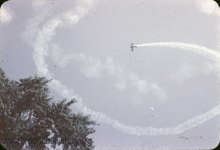
Cole Brothers airshow, July 5, 1953. Photo by Truman Olin, courtesy of Brodhead Historical Society.
In 1973, a group of pilots and interested residents formed EAA Chapter 431 at Brodhead Airport. Shortly after, Wheeler Searles passed away but not before arranging to give Chapter 431 members the option to purchase the airport from his estate. Two corporations were formed (Hawk Aire and Eagle Aire) to acquire the real estate along with additional acreage to make a runway extension to the west.
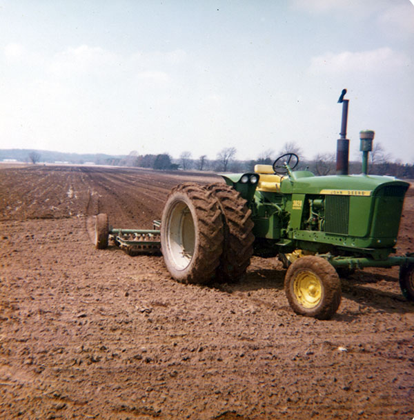
Equipment from the Badertscher family farm grades runway 9-27 after land was purchased to extend the runway to the west.
On January 17, 1973 The Experimental Aircraft Association granted charter to Cheeseland Chapter 431, Inc. Several local people were actively involved in pursuing charter status for Brodhead. The nineteen charter members were:
| Fritz Badertscher | Robert Reis |
| Donald Cooley | Wheeler Searles |
| Robert Earleywine | Kenneth Segner |
| Robert Green | Gerald Steiner |
| Kent Jornalien | Francis Saunders |
| Vernon Knezel (Sec./Treasurer) | Richard Weeden (President) |
| William Knight (Vice President) | Stanley Wraight |
| Ralph Klassy | Donald Wichelt |
| Leonard Kitchen | Robyn Wichelt |
| Robert Paulik |

Richard Weeden’s office and hangar under construction, 1976. Fuel pumps are in the foreground.
Almost immediately, Chapter 431 members and other local pilots constructed new hangars and brought a variety of new aircraft to Brodhead Airport. A photo gallery showing local pilots in 1974 can be viewed HERE.
In the years following, the two corporations were merged and now, Hawk Aire owns the airport outright, with shareholders in the corporation made up of hangar owners on the field along with a few non-pilots who helped with the original purchase in 1973. Since Brodhead Airport is privately owned, it receives no government funding either from the city of Brodhead, Green County, the state of Wisconsin or the FAA.
56 hangars are now on the airport and at nearly 75 airplanes in various stages of construction. The little airport is now known around the country as one of the best grass airports in the midwest and is host to several major fly-ins every year; a Community Pancake Breakfast, a three-day Pietenpol/Hatz convention in July, a private three-day gathering of the Midwest Antique Airplane Club in September and a ski fly-in each February. Check the Calendar of Events page for details. Camping on the field is available year-round.
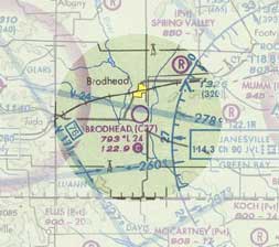
Brodhead Airport carries FAA designator C37 and while it is privately owned, it is open to the public and carries no landing restrictions. Its three grass runways are symbolized on the Chicago sectional chart with an open circle. It is in uncontrolled, or class G airspace, underlying class E, the least restrictive of controlled airspace. The nearest airspace requiring radio contact is the Janesville (JVL) class D about 10 miles east of Brodhead. The Madison (MSN) class C airspace begins about 30 miles north.
The airport is about 1 mile south of the city Brodhead near the junction of state highways 11 and 81. The nearest hard surface airport is Monroe (EFT) about 11 nm west. The nearest instrument approach is also at Monroe, while Janesville (JVL) has full ILS capability. Madison (MSN) and Rockford (RFD) both offer radar service in the area.
The airport area is fairly flat with a few trees. The perimeter is mostly surrounded by irrigated fields and pilots should watch for irrigation rigs near the airport perimeter. There are no tall towers or obstructions that affect the traffic pattern. The six runway thresholds are displaced for controlling objects.
Airport elevation is 793 feet. Traffic pattern altitude is 800 feet AGL or 1600 feet MSL. The active runway is dictated by surface winds. During busy times when winds are light or calm, runway 27 is considered the active. During fly-ins check surface markings as other runways may be closed. The Common Traffic Advisory Frequency (CTAF) is 122.9. Monitor and call your intentions and be vigilant as many aircraft using the field are non-radio equipped. Fly standard left-hand traffic patterns and look for aircraft possibly flying patterns to other runways. Please be predictable near the airport.

The runways are not plowed in winter and the airport is open to ski equipped aircraft.
More information about Brodhead Airport is available on AirNav.com.